[For urgent updates please follow Ukrainian Freedom News in Telegram]
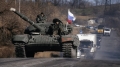
After 22 days of the war in Ukraine, Russia has stopped active offensives and continues regrouping its forces. However, despite the heavy losses which are approved both by the Ukrainian officials and American Intelligence, the terrorist state still conceals the reality from its society.
According to the General Staff of the Ukrainian Armed Forces, the Russian army lost its offensive potential, was stopped in all directions and continues suffering significant problems with logistics. As of March 17, the occupiers control bigger parts of the Kherson and Zaporizhzhia regions, keeping Mariupol under siege, which is the most strategic point on the Azov coast. The parts of the Kyiv, Chernihiv, Sumy, Kharkiv, Donetsk and Luhansk regions are also temporarily occupied by Russian troops, and recently, they were repelled from Mykolaiv by the Ukrainian defenders. The situation is evidenced by the regularly updated volunteer map of the Ukrainian Telegram channel DeepState:
For the comparison, we attach the relevant maps created by the Western agencies:
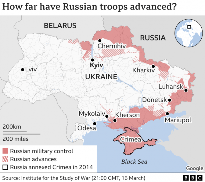
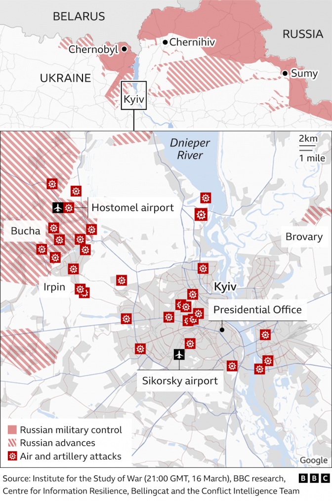
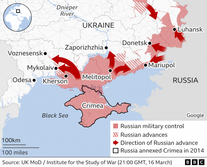
Taken from BBC article
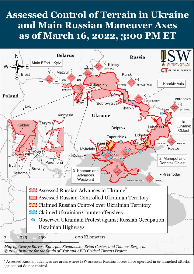
Source: Institute for the Studies of War
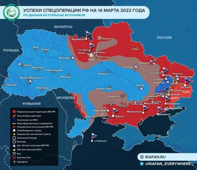
At the same time, Putin’s propaganda presents to Russians a totally different picture. The fake image below shows the allegedly encircled Kyiv and Kharkiv, fully occupied Chernihiv and Sumy, while land fightings are illustrated near Odesa, Kryvyi Rih, Kropyvnytskyi [indicated as Kirovohrad – the city’s name before decommunisation], Poltava and even Zhytomyr. This propagandist map also shows that the main goal of the so-called «special operation» is almost completed – namely, expanding the terrorist states DNR and LNR to the administrative borders of the Donetsk and Luhansk regions, although it’s also far from reality. The resisting Ukrainian forces (blue) are painted like being in the encirclement. We must also note that Crimea is shown as the regular territory of the Russian Federation where the hostilities do not take place, while the temporarily occupied Ukrainian areas of Donbas (where the so-called DNR and LNR claim to be located) are painted in a different shade of red to differentiate them from other Ukrainian territories, where Russia invaded during the last three weeks.
Source: Riafan.ru, shared in the Telegram channel Riafan_Everywhere
We will note that the information on this propagandist map is a total fake and can be rejected with the obvious facts that can be found in the free access.
By Vitalii Holich
Follow Lviv Now on Facebook and Instagram. To receive our weekly email digest of stories, please follow us on Substack.
Lviv Now is an English-language website for Lviv, Ukraine’s «tech-friendly cultural hub.» It is produced by Tvoe Misto («Your City») media-hub, which also hosts regular problem-solving public forums to benefit the city and its people.