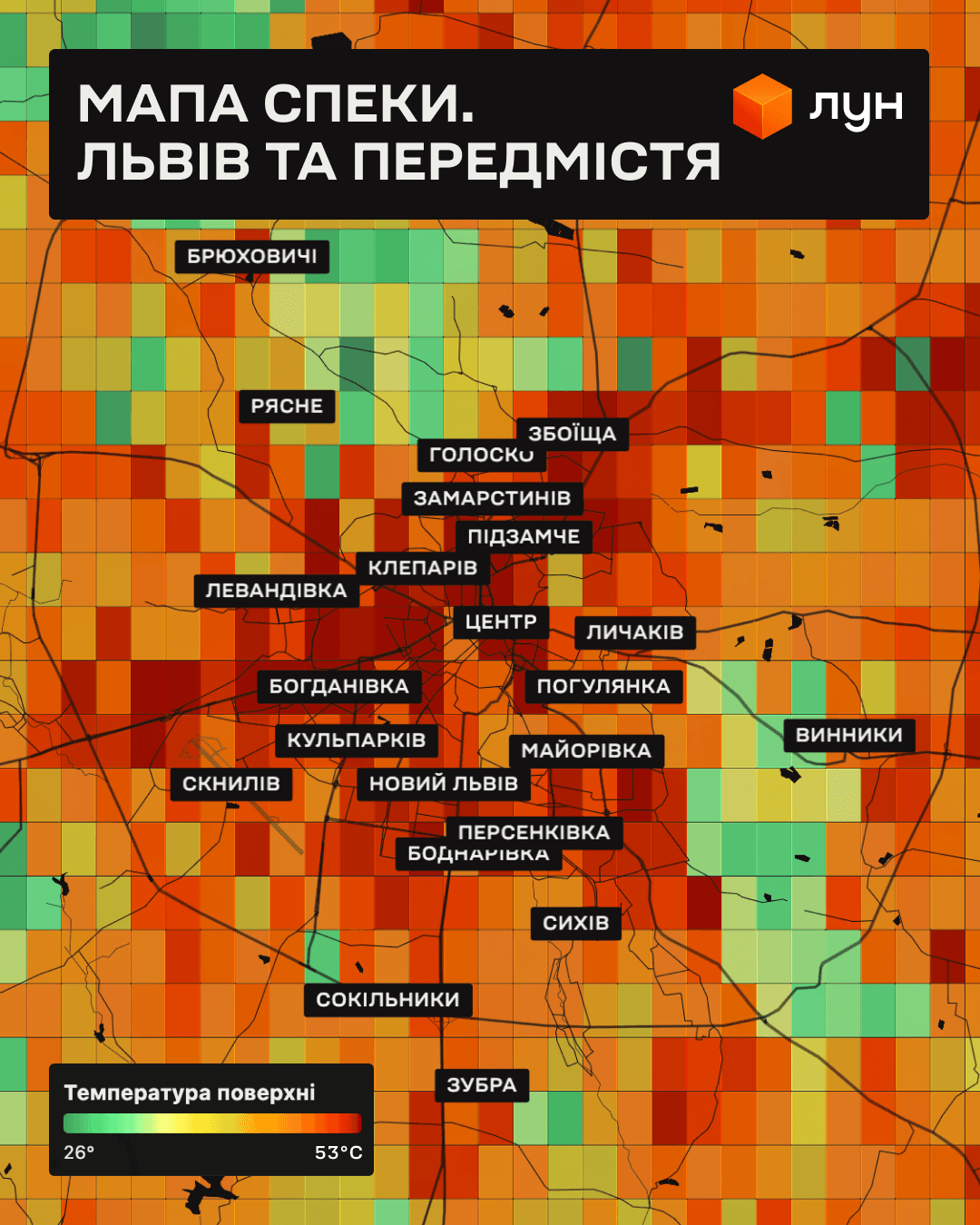
LOON has created heat maps for Lviv, Kyiv, Ivano-Frankivsk, Odesa, Crimea, as well as for Paris and Warsaw. The data was obtained from satellites of the European Copernicus Sentinel-3 program for June 26-29, 2026.
It is worth noting that the maps show not air temperature, but surface temperature – roofs, asphalt, soil, water, and vegetation – at the moment of satellite flyover around noon.
The study clearly demonstrates the urban heat island effect: densely built-up areas consistently heat up more, while large parks, forests, and water bodies remain significantly cooler.
Read also: A sharp drop in temperature is expected in the Lviv region: weather forecast
In Lviv, the hottest areas were the central quarters, Levandivka, Kulparkiv, and industrial districts, while Bryukhovychi, Vynnyky, and large green areas remained significantly cooler.
The absolute maximum in the studied area of Kyiv was 51.2°C. Within Kyiv itself, the highest surface temperatures reached up to 47°C. In contrast, Holosiivskyi Forest, Koncha-Zaspa, the Dnipro River, and the Kyiv Reservoir remain 10-15°C cooler than the surrounding development.
A no less noticeable effect is observed in other cities. In Ivano-Frankivsk, the central part of the city and dense development heat up the most, while cooler temperatures are recorded near green zones and water bodies. In Odesa, the temperature contrast is particularly well visible between the central quarters and the coast: the coastal strip and the sea naturally cool the surrounding areas.
Among the cities included in the sample, the highest surface temperatures were recorded in Ukraine. In Odesa, the surface heated up to 52.9°C, and in Crimea – up to 54.5°C, exceeding the maximum values in Paris (47.2°C) and Warsaw (50.1°C). Climatic features of the region, steppe landscape, and large areas of open surfaces play a significant role in this.
The maps are built on open data from the European Copernicus program. Information from satellites Sentinel-3A and Sentinel-3B, equipped with a Sea and Land Surface Temperature Radiometer (SLSTR) with a spatial resolution of about 1 km, was used. The data is open and free.
Recall that last year, a study was conducted in Lviv to determine which urban spaces overheat the most in summer and how residents can protect themselves from the heat. Results are available at the link.